
Uh, what's that? "Bridge" Street in what comprised the 24th Ward in 1863? An armory at 38th and anything around, what, where Presbyterian Hospital is now? I mean, I know there's an armory on 32nd Street on the Drexel University campus; but this poster couldn't be off by 6-plus blocks, could it? And, really, Bridge Street? That sounds so Frankford-before-they-renamed-Bridge-Pratt-Station, not West Philadelphia. And I'm almost certain that Philadelphia's city line didn't reach that far in 1863.
Oh, man, I gotta figure this one out.
So the 24th Ward has had other wards carved out of it a few times in the past, the first in 1866. So I had to find a pre-1866 map of the city, labeled with wards. Some interesting Googling brought me to a huge PDF of an 1862 atlas of Philadelphia. Here's a relevant screenshot:

I've had to seriously shrink the file size to make it the least manageable here, but here's the gist: The diagonal street is, of course, Lancaster Ave, then "Lancaster Road." The obscured name up top is Haverford Ave, then merely a "Street." Below, "Garden" is just that, simply Garden Street; and below Bridge Street is Hamilton Street, which is two blocks north of Powelton Ave.
Is that a trolley line on Bridge Street, too?
Now dig the modern map:

I had some trouble with this at first. At first, I thought the scale was badly off on the old map, but then figured it shouldn't be for 1862 cartographic technology. Did Bridge Street turn into backyards between Hamilton and Garden? Because isn't that old Garden the same as the modern Spring Garden?
In a word, nope. First, for orientation, it looks as though Crean Street turned into Warren Street at some point. I don't know who Crean or Warren was, or when the change happened. Also, the intersection of Lancaster and Haverford Aves used to be a broad open space, which I imagine was spectacularly hazardous in that era between the introduction of automobiles and the introduction of traffic lights. But here's the main thing: old Garden Street wasn't renamed Spring Garden; it was renamed Brandywine. It's Bridge Street itself that was renamed Spring Garden Street. What you see as a trolley line on Bridge Street is now the #43 bus on Spring Garden Street (PDF), a route that's been in service in one form or another since freaking 1842. Look what used to be over at the river:

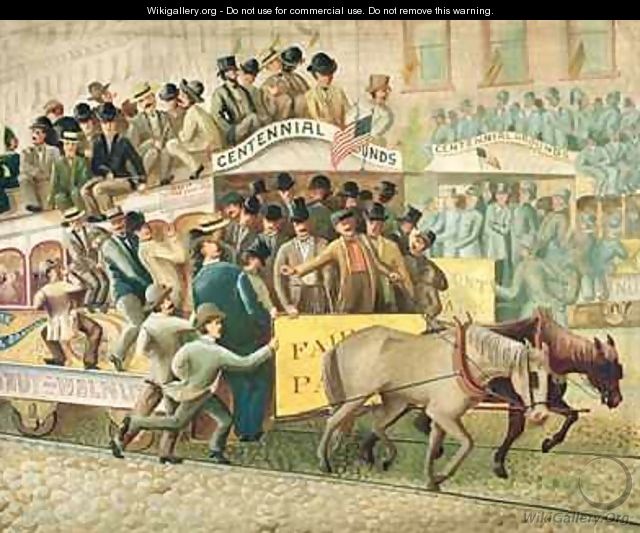
That's the double-decker "MFRR" bridge -- it carried what was the Hestonville, Mantua & Fairmount Passenger Railway Company in 1884. (The Mantua side was connected to the Callowhill side by 1876, though it's visibly two different railroads here in 1862.) Before electrification, the line was served with horse-drawn streetcars, or "horsecars":
 I'll leave a comparison with modern-day rush-hour commutes on SEPTA vehicles as an exercise for the reader.
But my point, and I had one when I started this post, was to figure out where this old armory used to be, and what's now in the Lot adjoining it. I mean, I don't even see an armory on the old map, though I have only that PDF I can zoom into it only so far. Maybe the armory is now the Mt. Pleasant Primitive Baptist church at 435 North 38th Street: it looks chunkier and squatter than it needs to be for a church, and maybe the U.S. Army or the Pennsylvania National Guard sold it cheap after the war ended. I'd like to find out, but would take more than some Internet research to try to find the property records. I think I'll go for a walk this weekend and see what I can see. In the meantime, never forget:


No comments:
Post a Comment